
Seismic survey: Exploration of the subsoil in southern Luxembourg

General context of the seismic survey
In 2015, a research study provided for the first time detailed evidence of the substantial potential of middle deep geothermal energy in Luxembourg. However, due to a lack of reliable data, deeper geothermal energy was neglected in Luxembourg until now, despite its academically promising potential to supply neighbourhoods via district heating networks. To confirm this potential and draw up a more detailed prognosis of the geothermal, geological and hydrogeological conditions, an additional feasibility study was necessary.
In an initial phase, an exploratory borehole was drilled in 2018 to a depth of 430 metres. This made it possible to determine in-situ geothermal parameters in the area.
In 2023, a seismic geophysical survey will be launched to gather information on an even deeper level of subsoil. At the same time, the geological assumptions will have to be verified, so that the optimum site can be identified along with the appropriate depth for subsequent middle-deep exploration drilling (800 to 2,000 metres).
Only after this exploration borehole has been drilled and the corresponding hydraulic tests have been completed, will it be possible to draw a definitive conclusion on the real potential of middle-deep geothermal energy in the south of Luxembourg.
The approach of seismic surveying
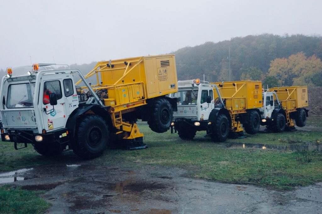
Like ultrasound, a geophysical seismic survey uses the propagation and the reflection of wavelengths generated at the surface to provide an image of the structure of the subsoil. Vibration waves of different frequencies are generated using a vibrating plate that is mounted on a truck and emit wavelengths into the ground at pre-defined points. Reflections off the geological layers at depth are then recorded by sensors known as geophones.
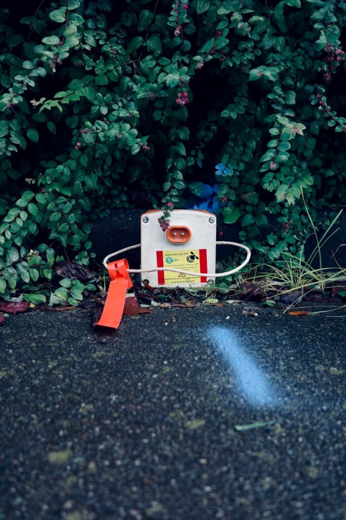
The geophones will be installed a few days prior to the measurements, while the trucks will travel along a predefined route as a mobile worksite. This convoy of 1 to 3 vibrating trucks will generate vibrations every 20 to 50 metres for 20 to 30 seconds. The geophones recording these mild vibrations will be collected once the project is complete. A total of around twenty people will be deployed on site for 2 to 3 weeks.
Schedule and deadlines
The current provisional schedule aims to launch the communication campaign after the 30th of October 2023 and to proceed with the field operations thereafter.
The company in charge of the works will prepare the entire operation over the coming weeks and months, with the support and under the supervision of the Service géologique de l’État